


PBCS … or how to plan a NAT-Crossing?
Great #flightdispatch #nerd news: I have the honor of training an new colleague in the following weeks 🤩
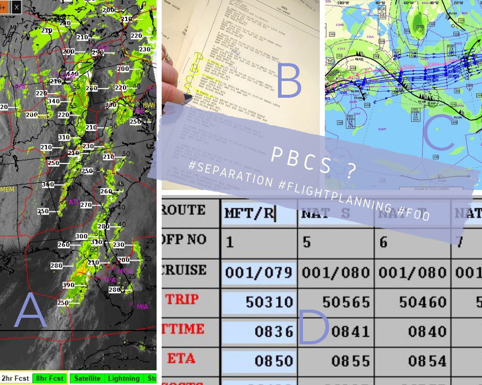
..and sure, I’m hoping for plenty of interesting #flightplan examples..like this TPA-FRA #flight.
#radar pics showed an active cold front with thunderstorms over the south eastern U.S., moving northeast (A).
Plus, the #airplane (an #a343) wasn’t certified to fly the PBCS (performance based communication & surveillance) NAT tracks (B).
*these are tracks with reduced lateral and longitudinal separation; takes latest COM/NAV equipment + certification to use these.
So, two no-go’s – and our #flightplanning system playing “paint by numbers” all along these 🙄 for optimum route (C, pink) and most efficient tracks (D).
Given NAT V was not an option at all and U/W only below FL350 (PBCS!), I 1st checked for a “fly-able” optimum as a reference.
Adding correct, #ATC-approved departures, transit routes towards the NAT tracks plus a legal EU route rendered the northern available tracks some 10 mins slower than initially calculated (let alone the route theough the front).
the core tracks below FL350 also turned out no option (low level, more fuel).
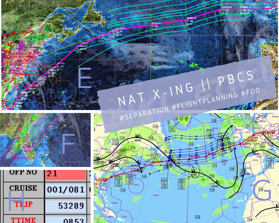
Different story for a track more south. For these, there’s two options for joining: either via one of the coastal routings – or from the south, via the “WATRS” area, e.g. when coming from Florida (E). Charming side effect: that would allow for a departure to the east – away from the #weather moving in on FL (F).
Finally, I opted for the red route (G): grossing in at just 3 mins slower (H) than the fastest, actually plannable option, but avoiding the weather (and joining an actually useable track).
Lesson learned (once again): all routes are relative – and so is any “optimum” 🤷🏼♀️
#flightplanningissexy #aviation #aviation4u #avgeek #foo #dispatcherproblems #flightdispatcher #ilovemyjob #aviationlovers #flying #plane #lovewhatyoudo #dowhatyoulove
17.04